A year after the Waitaha Canterbury floods
On 30 May 2021, a region-wide state of emergency was declared in Waitaha/Canterbury following days of sustained, heavy rainfall that caused extensive flooding.
One year on, we reflect on works undertaken to protect communities and their livelihoods and look forward to what more could be done to safeguard people, properties, and assets to build resilience for communities.
A record-breaking weather event
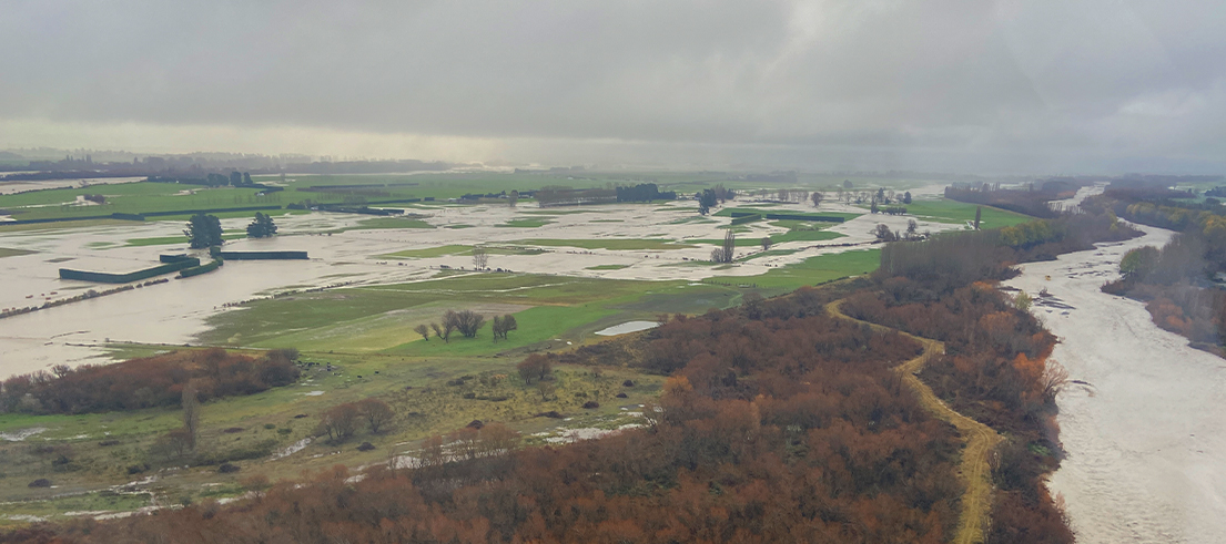
Intense rains began on 28 May 2021, affecting the region from the Mackenzie to Waimakariri districts, with the most significant flooding impacting the Hakatere/Ashburton River catchment area.
The largest 72-hour rainfall totals since records began were recorded at a few rain gauges across Waitaha. The downpour led to Hakatere/Ashburton and other inland areas experiencing flooding so extreme that it might only be expected to happen once in 200 years.
Assessing the damage
Flood damage affected community infrastructure and public and private property. Shingle and silt was deposited onto private property and has built up throughout rivers. Many flood protection assets were significantly damaged or destroyed, including:
- Stopbanks, designed to restrict out-of-river flooding, were eroded and, in some cases, completely severed.
- Large sections of flood protection vegetation, which plays the critical role of slowing floodwater and reducing erosion, were lost.
Physical works began directly following the event, with our focus on reducing the immediate flood risks to homes, farms, and essential infrastructure.
Flood protection repair works continue
Replacement or repair of stopbanks was needed at 46 locations across Waitaha, with about 5km of stopbank needing to be rebuilt. Flood protection recovery manager Shaun McCracken said repairs are progressing well, with most stopbank breach locations either repaired or under contract to start repairs shortly.
The biggest job in the flood recovery project, and our operational focus this winter, is replacing river berm vegetation needed at 148 sites or groups of sites over 42km across the region. Because vegetation can take years to establish, we are including additional, site-specific design elements to reduce the short-term risk of erosion while the vegetation grows and matures.
So far over $10 million has been spent on the flood recovery project, and will total $20 million by the time works are completed. The cost will only cover replacement infrastructure on a ‘like-for-like’ basis and doesn’t include additional costs for potential improvements.
“Looking to the future, we are considering options for improvements to the infrastructure that was previously in place, to account for climate change and the likelihood of more frequent and intense rainfall events,” Shaun said.
Flood repair progress is available on our real-time flood damage repair status map.
Flooding and the effects of climate change
A year after the floods hit there are those whose lives continue to be affected by the damage. Their situation is not unique and is on the way to becoming more common, as climate change is set to increase the frequency and severity of floods: Aotearoa’s most common natural disaster.
Thankfully no human lives were lost to this event; a reminder of the role our flood protection plays in protecting the health and wellbeing of communities and critical infrastructures like roads, community water supplies, and power lines.
Earlier this year, we led a call for urgent action from central government to invest more to minimise climate change-induced flood hazard risks. Shared investment today means better protection for current and future generations, lower recovery costs and importantly, improvements now may save lives.