Waitaki lakes' water quality results shared
A detailed summary of water quality in the lakes was shared with the Upper Waitaki Water Zone Committee meeting in December.

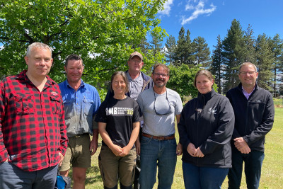
The Upper Waitaki Water Zone Committee received a water quality update and new groundwater research from our science team at its December meeting
The committee, who met in the shearers’ quarters at Omarama Station, were able to ask questions and find out more about lake water quality monitoring results and a new a groundwater study as part of its regular public meeting.
Chair of the committee, Mat Bayliss, said water quality is an important issue for our communities.
"We’re coming up to our busy summer season here in the lakes, so it’s important we have the latest information to share" he said.
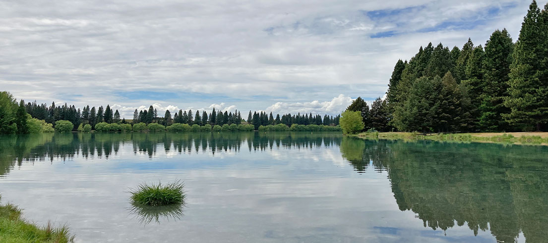
Swimming sites look good ahead of summer
We monitor 11 popular swimming sites across the Upper Waitaki region for health risks over summer. Shirley Hayward, surface water science team leader said, in general, all lakes in the Upper Waitaki area are graded suitable for swimming, except for 48 hours after heavy rainfall.
"The lakes continue to be a great option for swimming and water sports. Just remember that heavy rainfall can impact water quality due to run-off from roads and paddocks, so wait a few days afterwards before swimming again," said Shirley.
"The other good news is that Lake Ruataniwha has continued to show low concentrations of faecal indicator bacteria (E. coli) and now has a suitability for recreation grade of very good. This is a great recovery after high E.coli levels closed the swimming area for several days in summer 2020."
At the request of the zone committee, we also sampled the popular but tiny waterway Loch Cameron in 2021/22. E. coli results showed generally low concentrations, and no results exceeded the alert or action levels. We will continue to sample Loch Cameron this summer.
The suitability for recreation grades are based on the past five years of E. coli data. To read the swimming grades for all sites in Upper Waitaki – and Canterbury - visit www.lawa.org.nz/swim
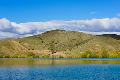
Lake health and nutrient levels reviewed
We also presented a comprehensive update on the latest results of annual monitoring for lake health water quality in the area – which is based on a measurement called the Trophic Level Index (TLI) that assesses total phosphorus, total nitrogen and algal biomass (chlorophyll a). Healthy lakes tend to have low levels of nutrients and algae in the water.
Shirley summarised that the three large natural lakes in the area (Ōhau, Pūkaki and Tekapo/Takapō) maintain very clean and very low nutrient water quality and remain within the ‘microtrophic’ band.
"The large lakes remain low in nutrients – and although there has been a slight increase since last year, this is likely to be a result of climatic cycles."
In addition, the three Lake Benmore monitoring sites all met the limits set in the Land and Water Regional Plan in 2021/22. In particular, the Ahuriri Arm TLI has improved in water quality in 2021/22 compared to the previous three years.
"This is encouraging, and efforts by landowners to control nutrient inputs to the lake are likely contributing to this improvement," added Shirley.
However, like previous years, the smaller lakes McGregor and Alexandrina did not meet the plan limits.
"There is year-to-year variation in the trophic status of these lakes and they are also impacted by climate patterns," said Shirley. "Smaller lakes can respond more quickly to climatic variations such as warming water conditions.
Climate change is likely to affect the quality and health of all our lakes, so we’ll need to closely monitor these sensitive environments."
Read the full report (PDF file, 32.3MB) to the zone committee.
2018-22 Trophic Lake Index (TLI) scores Lake Benmore
| When | 2018 | 2019 | 2020 | 2021 | 2022 |
|---|---|---|---|---|---|
| Lake Benmore - Haldon | 1.73 | 2.12 | 2.21 | 1.95 | 1.95 |
| Lake Benmore - Ahuriri | 2.29 | 2.94 | 2.75 | 2.80 | 2.80 |
| Lake Benmore - Dam | 1.89 | 2.19 | 2.32 | 1.77 | 1.77 |
Description of trophic states and Trophic Level Index (TLI) scores
| TLI | Tropic state | General description |
|---|---|---|
| <1 | Ultra-microtrophic | Practically pure, very clean, often have glacial sources |
| 1-2 | Microtrophic | Very clean, often have glacial sources, very low nutrient concentrations |
| 2-3 | Oligotrophic | Clear and blue, with low levels of nutrients and algae |
| 3-4 | Mesotrophic | Moderate levels of nutrients and algae |
| 4-5 | Eutrophic | Green and murky, with higher amounts of nutrients and algae |
| 5-6 | Supertrophic | Very high nutrient enrichment and high algae growth |
| >6 | Hypertrophic | Saturated in nutrients, highly fertile, excessive algae growth |
Study shows clearer picture of groundwater
New research has been completed on the Wairepo Arm near Lake Ruataniwha
At the same meeting, we presented an overview of a recently-completed study on the flow paths of groundwater (the water that is below the land surface ) into Wairepo Arm and Kellands Pond. Read the full report (PDF file, 32.3MB) in the agenda.
Wairepo Arm and Kellands Pond are two small lakes located to the south of Lake Ruataniwha that are sensitive to nutrients, so have additional restrictions on farming and land use near them, set in the Land and Water Regional Plan.
When considering water quality limits for this area, the Upper Waitaki Zone Committee recommended that we should conduct research to better understand the movements of nutrients from groundwater and surface water into these two lakes, to help inform future decision making.
After an initial research and planning stage, we undertook an investigative drilling program in 2020 to install eight shallow piezometers (groundwater level measuring tubes) adjacent to Wairepo Arm and Kellands Pond and three monitoring wells in the wider catchment of the two lakes. The work was conducted with cooperation from local landowners.
A survey then measured groundwater levels across the catchment using the newly constructed piezometers and monitoring wells, in addition to existing monitoring wells and some private wells.
The team also surveyed water levels in Wairepo Arm and Kellands Pond, as well as several locations along Wairepo Creek, to compare surface water elevations to groundwater levels.
Senior scientist - groundwater, Kate Bailue, said the results have led to much better understanding of how the groundwater flows across this catchment.
"Now we have much clearer evidence that local groundwater levels surrounding Kellands Pond and Wairepo Arm rise and fall with the lake levels, demonstrating the close connection between groundwater and the lakes.
"Also, the data collected shows that groundwater in the catchment of the two lakes generally flows towards the north-east, from the hills in the upper part of the catchment, across the Ostler Fault and into the two lakes."
Understanding the flow path results
The Upper Waitaki Water Zone Committee in Omarama
Because groundwater from the catchment ultimately flows into Wairepo Arm and Kellands Pond, any nutrients that are leached into the groundwater, including nutrients from the upper part of the catchment (west of State Highway 8 and the Ostler Fault) are likely to be transported to the two lakes.
"This means that intensive farming activity in this further away area is likely to be having an impact on the Wairepo/Kellands Pond lake systems," said Kate.
The information will be beneficial for understanding the science of the wider catchment and for decision making.
"It's additional information that can help our understanding when considering our planning for the area or new consent applications," Kate added.
The Upper Waitaki Water Zone committee will meet again in the new year to work through its 2023 Action Plan for the area and identify new projects it could support.