How your rates are spent
Your rates are used to carry out important work in your area. The work being carried out currently sits under our five portfolios, agreed by the community through our Long-Term Plan.
These five portfolios of work are:
- Water and Land, for example, monitoring the quality of the water in our rivers and lakes.
- Biodiversity and Biosecurity, for example, managing and controlling pests.
- Climate Change and Community Resilience, for example, Civil Defence readiness activities.
- Air Quality, Transport and Urban Development, for example, providing bus services.
- Regional and Strategic Leadership, for example, the administration of processing consents.
You can use our online rates tool to see how the different portfolios and programmes of work are funded. You can look by project, or by area in map view.
Changing how we deliver our work
We are currently transitioning from a portfolio approach to being in a position to deliver three core services:
- Environmental Regulation and Protection,
- Community Preparedness and Response to Hazards
- and Public Transport.
Once our next Long-Term Plan is adopted in June 2024, we will update this page.
Your rates at work
The below activities are funded by your rates and align to one of our five portfolios of work.
Air quality
Did you know that over the last ten years, we have recorded approximately a 50% decrease in high pollution nights across Canterbury?
Monitoring air quality
We may have improved, but we’ve still got a lot of work to do.
Your rates allow us to carry out the activities in the Canterbury Air Regional Plan and assist with getting new home heating technology into people’s homes.
Work can include:
- Monitoring the air quality across Canterbury
- Recording data to help inform which areas need to take action
- Providing education on how to reduce pollution from burning
- Providing grants to help cover the costs of installing better forms of heating.
The Air Quality rate and the Air Quality heating assistance rate are targeted rates set for properties in Rangiora, Kaiapoi, Christchurch, Ashburton, Timaru, Geraldine and Waimate, as these areas have been identified to have the biggest impact on air quality in Canterbury.
The rates are based on capital values and cover the cost of monitoring these areas to assist in reducing air pollution.
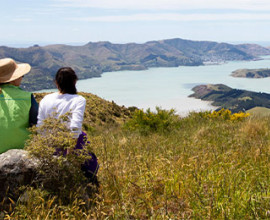
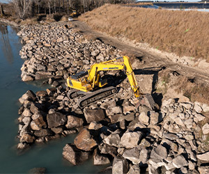
Flood protection and catchment works
Did you know without flood control work the Waimakariri River would not flow along its current path?
Flood control work/stopbanks in the Rangitata River.
Your rates fund river control and flood protection work to reduce the impacts of flooding. This rate is based on how close your property is to a flood-prone river.
Your rates bill has a code to indicate which river catchment your property lies within, and a class to indicate the level of benefit it receives from the river control and flood protection work we do in that catchment.
Classes go from A to F. Class A required the most protection (i.e., is located in higher-risk flood prone areas) and pays a higher targeted rate.
Class F pays the lowest targeted rate for this work and Class U means your property is located in an urban area.
Work can include:
- Protection of the groundworks surrounding major bridges
- Protection of telecommunication lines on waterways
- Flood control work/stopbanks
- Lake openings
- Sea buttresses
- River drainage
Civil Defence Emergency Management
Did you know Civil Defence runs scenario training to help prepare and equip staff and volunteers for future emergencies?
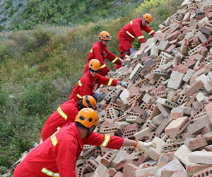
Scenario training to help prepare and equip staff.
Your rates fund services for Civil Defence Emergency Management (CDEM), making sure we’re prepared to respond to and recover from any emergency.
We provide support to the Canterbury CDEM Group to help coordinate and deliver emergency management services across Canterbury, through partnership with local authorities (with an exception of Waitaki which is covered by the Otago CDEM Group), the regional Council, iwi, and partner agencies.
Work includes:
-
Planning activities
-
Building relationships with other emergency response organisations
-
Improving awareness and understanding of risks, hazards and impacts
-
Training staff and volunteers
Pest management
Did you know wilding pines were introduced for shelter belts, erosion control and plantation forests and are spreading at a rate of 5% annually? We remove and control wilding pines on 500,000 hectares of land in Canterbury annually.
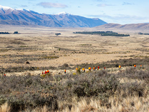
Wilding pines control programme in the Mackenzie Basin
Your rates fund work to control invasive and destructive species, to keep the Canterbury ecosystem thriving, and protect our native flora and fauna.
Work includes:
- Inspection
- Advice
- Education
- Monitoring
- Investigation
- Control of animal pests (eg rabbits)
- Control of plant pests (eg wilding pines).
Pest management targeted rates are collected as per the Pest Management Plan and Revenue and Financing Policy (PDF file, 2.85MB).
The Pest-free Banks Peninsula targeted rates cover all of Banks Peninsula and the surrounding city areas of Sumner and Redcliffs.
This is applied to all properties both rural and urban in these areas and is additional to any other regional pest rates collected.
Public transport
Did you know on an average weekday in Greater Christchurch there are 31,730 passenger trips on our buses?
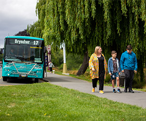
Providing support to our community
Your rates fund public transport including administration and planning.
Public Transport is the largest single part of our annual budget and is important to reduce transport emissions, as well as provide sustainable travel options.
We provide three types of public transport in the Canterbury region:
- Urban public transport services in Greater Christchurch and Timaru
- Subsidised door-to-door transport services for people with mobility impairments as part of our Total Mobility scheme
- Funding grants for Community Vehicle Trusts.
Work includes:
- Timetabling
- Providing and maintaining bus stops, seats, shelters, displays
- Customer service Metro agents
- Administration and planning
- Policies on fares, funding, vehicle quality, service standards, procurement, infrastructure and monitoring.
Greater Christchurch Transport and Urban Development
Did you know around 80% of the region’s population live in Greater Christchurch?
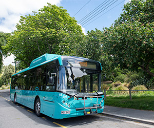
By 2023, 92 new buses — that’s 40% of the Metro fleet — will be electric or low emission.
Your rates fund the support, planning and development of initiatives for regional transport systems and urban development.
Regional transport includes initiatives and network resilience for rail and shipping as well as road transport safety and actions to help reduce Canterbury’s transport emissions.
In collaboration with councils, government agencies and iwi, we contribute to the implementation of the Greater Christchurch Urban Development Strategy (UDS).
The UDS sets out the vision and goals for development in Greater Christchurch and details the key actions required to deliver these goals. Work includes supporting housing and business needs for a growing population.
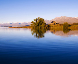
Freshwater management
Did you know we support ten water zone committees?
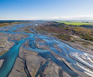
The Waimakariri River is only one of many braided rivers in Canterbury
We are responsible for managing the region’s water and the Canterbury Water Management Strategy (CWMS) provides a collaborative framework to help manage the multiple demands on this precious resource.
The CWMS Environmental Infrastructure rate is a targeted rate set on districts deemed to benefit and is based on capital value.
Work includes:
- Supporting actions to increase water quantity (levels) in low-flow streams/rivers
- Supporting landowners to protect and enhance waterways using fencing and planting
- Collecting data on water quality and quantity
- Allocation of water (drinking, irrigation etc.)
- Controlling the taking, use, damming and diversion of water
- Compliance to manage discharges to waterways
- Sharing data and research to understand trends and actions needed to improve water throughout the region.