Iongairo: Partnership makes waves in mapping the seafloor
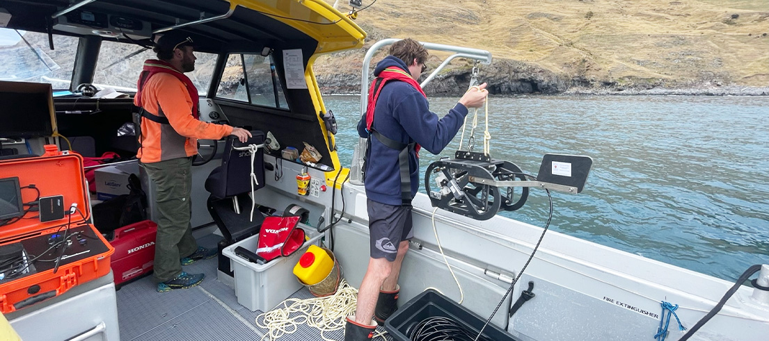
A project taking a deep dive into understanding the seabed and marine ecosystems around Te Pātaka o Rākaihautū/Banks Peninsula is underway.
Iongairo is a collaborative partnership between papatipu rūnanga of Te Pātaka o Rākaihautū, the Department of Conservation and Environment Canterbury. Iongairo is a Māori word representing the relationship between Papatūānuku and Tangaroa — the first knowledge of the meeting of the whenua/land and the moana/ocean.
In 2021, the Iongairo partners worked with Toitū Te Whenua Land Information New Zealand (LINZ) as part of its national hydrographic survey work and expanded the survey area around Te Pātaka o Rākaihautū to include shallow coastal areas. LINZ needed the data to update maritime charts, and the partners saw an opportunity to build very accurate physical and biological habitat maps of the seafloor.
The Iongairo team will identify and assess habitats (such as rock, sand, and mud) and species (such as pāua, mussels, and seaweed types) of importance, and look at the impact of human activities on the environment. User-friendly, online maps of the seafloor will be developed, and the data collected will also help researchers to assess and predict the impacts of climate change on key habitats and species. Knowledge gained through the project will ultimately help rūnanga, communities and agencies to make informed decisions on ecosystem management.
Ōnuku Rūnanga Chairperson Rik Tainui said the Iongairo project supports Ōnuku whānau to be good kaitiaki of Te Pātaka o Rākaihautū.
"As mana whenua, Ōnuku whānau have kaitiaki responsibilities in the area, and this project will provide key information to help us look after the ecosystems and biodiversity we have been connected to for generations."
Wairewa Rūnanga mana whenua mana moana team leader Robin Wybrow said Ngāi Tahu tīpuna were marine experts who studied their environment, and this programme will see their mātauranga/Māori knowledge passed on to future generations.
"This is a fantastic opportunity to work in collaboration with our Tiriti partners to determine the best methods for restoring mahinga kai habitat and exploring ways for our people to become recognised marine experts within their takiwā.
"We are hopeful that data from this programme will achieve positive outcomes for mahinga kai species and inspire rangatahi to pursue science as a career, including mātauranga Māori, so they can become experts in mahinga kai like their tīpuna before them."

Kōura/crayfish found on the Banks Peninsula seabed
University of Otago appointed as science partner
Earlier in 2022, the University of Otago was appointed as the project’s science partner. The Otago team will work with the project partners to interpret data and undertake further research to help understand drivers of change and connections between the land and the sea.
University of Otago research fellow, Dr Matthew Desmond, said the Iongairo project represents a significant advancement in understanding the distribution and health of marine systems and taonga species around Te Pātaka o Rākaihautū.
"We're working together to meet the data needs of coastal managers and kaitiaki - the combined involvement of government, rūnanga and communities is essential if we are to achieve true co-management of marine resources. We strongly support this approach and feel privileged to work alongside the partners in this project."
Laying the groundwork for future opportunities
The project, with an investment of $1.8 million through our Long-Term Plan 2021-31, as well as funding and in-kind vessel support from the Department of Conservation, is set to run until June 2024, with the intention that it will seed further research opportunities and areas of study.
Our chief scientist Dr Fiona Shanhun said this is almost certainly the largest investment in marine science ever seen around Te Pātaka o Rākaihautū.
"Our collaborative approach is a commitment to delivering value to rūnanga, communities and marine ecosystems themselves. We’re working together to enhance the way we manage marine ecosystems, now and for future generations."
Department of Conservation’s Director of Eastern South Island Jo Macpherson said it’s exciting to be involved in a collaborative project that will contribute to better management of Banks Peninsula’s marine environment.
She said marine habitat mapping is identified in Te Mana o te Taiao (the Aotearoa New Zealand Biodiversity Strategy) as a necessary step towards better protection of marine biodiversity in Aotearoa.
"It’s vital to understand where different habitats are and how marine life uses them, so we can all look after it more effectively."