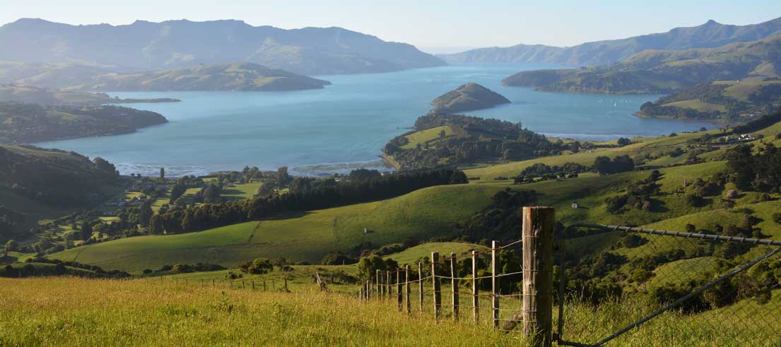
What’s the story with flood protection in Banks Peninsula
Flooding is Aotearoa New Zealand’s number one hazard and an issue many Canterbury communities live with, particularly those located on floodplains or alongside river systems.
Canterbury Regional Council Rivers Manager David Aires says the recent flood event has had a significant impact on people and businesses in Banks Peninsula.
“We acknowledge everyone who has been impacted by the recent severe weather and flooding. We recognise that beyond the physical damage to homes, businesses, and infrastructure, these events bring emotional strain, uncertainty, and stress to individuals and families across the community.”
Understandably, this has led to questions from the community about how rivers are managed, what local and regional rates are used for, and how flood protection decisions are made.
Our role in flood protection
Across Waitaha Canterbury, we work with our communities and central government to deliver projects that increase flood resilience (lessen the likelihood and impacts of flooding).
Flood protection schemes are designed using a risk‑based approach, balancing the likelihood and consequences of flooding with the cost of providing protection. That cost normally falls on the communities that benefit from the work. While it might be technically possible to design infrastructure to withstand increasingly extreme rainfall, doing so can often be prohibitively expensive.
Some areas have comprehensive flood schemes that include infrastructure like stopbanks and flood gates, in other areas there’s no infrastructure, but we carry out river maintenance and this typically includes managing vegetation growth and removing debris that can obstruct flows and reduce channel capacity.
This type of maintenance work plays an important role in reducing everyday flood risk and helping rivers function as designed. It supports drainage during normal rainfall events and helps prevent small blockages from becoming larger problems.
Unfortunately, no river scheme can prevent flooding when rainfall is heavier or more sustained than the system is designed for.
River rating districts help decide and fund work
We deliver flood protection and river management through 59 river and drainage rating districts, or schemes. These schemes are largely funded by a targeted rate that the community pays based on the level of flood protection they agree through community consultation and long‑term planning.
The Wairewa rating district was established in 2015 and covers Little River, Cooptown, and the Okana, Okuti, and Takiritawai River floodplain areas. It funds an annual river maintenance programme focused on channel clearing, removing vegetation and limited bank stabilisation work. There is no flood protection infrastructure in any of these areas maintained by us as part of this scheme.
Larger‑scale flood protection in this area would require a different scheme design, higher funding, and community agreement. We are aware that Christchurch City Council is considering investigations into future options to reduce flooding impacts, and we are actively supporting them in those conversations.
Lake openings
Questions are sometimes raised about lake openings following flooding events. Lake openings are governed by specific resource consents. Christchurch City Council holds the consent for Te Roto o Wairewa/Lake Forsyth, so they make decisions on when to open the lake. Environment Canterbury is not a decision‑maker in that process.
Looking ahead in Banks Peninsula
The recent flooding has highlighted the need for broader conversations about long‑term flood resilience in Little River. That includes discussions about:
- what level of protection is appropriate for the community, and
- how larger‑scale work might be funded.
Flood risk is shaped by geography, climate, and land use, and managing it requires a mix of maintenance, infrastructure, funding, and community decision‑making. The Wairewa rating district plays an important role in maintaining local waterways, but it is only one part of a much larger picture.
Understanding that distinction helps set realistic expectations – and creates a clearer foundation for conversations about how communities want to prepare for future flood events.
Advocating for more co-funding for the region
Across the country, funding is the biggest constraint on how quickly flood protection can be upgraded.
We work alongside Te Uru Kahika and the rest of the regional sector, to advocate for central government co‑funding to recognise flood resilience as a shared national responsibility. The introduction of Regional Infrastructure Fund co‑funding in 2024 marked a significant shift toward shared investment, and while it has accelerated critical projects, we continue to push for long‑term funding as flood risk increases.
Community Preparedness and Response to Hazards Core Service Lead Councillor Ian Mackenzie says flood resilience delivers benefits well beyond local communities, especially in places like Banks Peninsula that welcome lots of visitors.
“It protects nationally significant infrastructure, essential services, supply chains and lifeline networks. That’s why central government cofunding is so important; the cost shouldn’t fall on local ratepayers alone. Cofunding has allowed us to bring forward projects from our Long-Term Plan and protect communities sooner, and we’ll continue working with central government to strengthen flood resilience across the region,” he said.