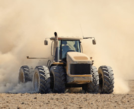
Make a plan, check irrigation restrictions and find advice on water use, farming practices and support for your farm.
El Niño impacts: what they could mean for you
We're expecting a very strong El Niño weather pattern this spring and summer. Find out what to expect, how to prepare, and where to go for support.
What El Niño could mean for Waitaha
The forecast El Niño weather pattern is expected to have a significant impact on the Waitaha Canterbury region, and especially on our farmers. Dry conditions, high winds, and flooding in Alpine rivers are all likely effects.
Where you live within the region will drive which impacts you are most likely to experience. Very dry conditions are forecast in the east - particularly in Banks Peninsula, North Canterbury and the Plains - while high rainfall is expected on the Southern Alps, feeding the headwaters of Alpine rivers and lakes.
Each El Niño pattern is unique, but history shows us that we need to prepare for an increased risk of wildfires, water restrictions, dry soil, severe wind and weather, and flooding. There are also lesser-known environmental effects to look out for such as toxic algal blooms or increased pest plant growth.
The good news is, we can minimise the impact on people, businesses, and the environment by accessing the high-quality information available to us and taking the time to plan ahead.
What to expect when Canterbury is dry
Earth Sciences is predicting the eastern parts of Waitaha will experience unusually warm weather combined with high winds. Possible environmental consequences include:
- An increased likelihood of drought and soil moisture stress in some places
- Water shortages and water bodies drying up
- Wildfires
- Flooding, including sunny day flooding from Alpine headwaters
- Fish strandings
- Restricted access to regional parks if fire risk reaches trigger thresholds
- Coastal river and lake closures
- Low levels in wells and bores
Many of these impacts have a disproportionate impact on our rural communities. Learn more about what to expect when Canterbury has very dry conditions.
How have past events played out?
While each El Niño weather pattern is unique and has different impacts on New Zealand, we can look at past events to give us an idea of the range of possible ways it may play out in our region.
- El Niño events in 1972–1973, 1982–1983, and 1997–1998 caused severe droughts in eastern parts of New Zealand. Historic recorded rainfall levels mapped by NIWA show the varying levels of severity during the three events in different parts of our region.
- As the 2015-16 El Niño weather pattern developed in early 2015, parts of the region were already in drought. In February 2015, the Government officially classified drought conditions for the eastern South Island as a medium-scale adverse event. These conditions continued throughout the year and into 2016. Parts of our region, particularly in Waimakariri and Hurunui, experienced near record low annual rainfall. Severe winds also caused very challenging conditions across the South Island and there were power outages in some areas as well as a dust storm in Twizel. At the time, this event was classed as one of the strongest events since 1950.
- The 2023-24 El Niño brought frequent dry westerly winds to Canterbury. A moderate adverse event was declared in March 2024 after months of warm, dry conditions, with monitoring showing record-low water levels at many sites. Several foothill rivers, mostly in South Canterbury, experienced some of their lowest river flows on record in February and March.
What can you do to prepare?
What can you do to prepare? Whether you manage a farm, own a lifestyle block or need information for your household, find advice relevant to your property and the support available to you.
Farmers and landowners
Lifestyle block owners
Find guidance on private drinking water, caring for animals and managing your property.
Residents and households
Find information about drinking water supplies and swimming water quality in Canterbury.
Forecasts and further support
Check the latest outlook and find advice to help you prepare and stay well.
Weather and climate outlooks
- El Niño 2026: What you need to know: Learn what El Niño could mean for New Zealand’s weather.
- Check the seasonal climate outlook: See the outlook for rainfall, temperature, soil moisture and river flows.
- Get the latest forecast: Find weather forecasts and warnings for your area.
Prepare for dry weather and emergencies
- Prepare your farm for El Niño: Find MPI advice and checklists for dry or wet conditions.
- Canterbury Civil Defence: Find local emergency information and preparedness advice.
- Make a household emergency plan: Plan what your household will do in an emergency.
- Prepare for wildfires: Learn what to do before, during and after a wildfire.
- Prepare for floods: Learn what to do before, during and after a flood.
Health and wellbeing
- El Niño and your health: Find advice on health risks and protecting yourself.
- Save water and stay healthy: Conserve water while protecting your health.
- Manage stress in an emergency: Find advice on coping with stress.
- Rural Support Trust: Get support for yourself, your family or your rural business.