Explore Canterbury’s world-renowned and unique braided rivers by meeting some of the people restoring their mana.
Stories
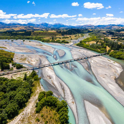
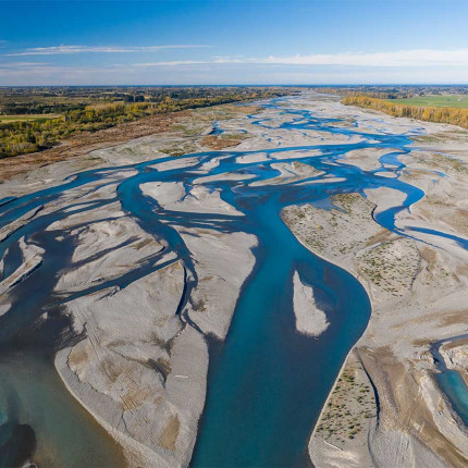
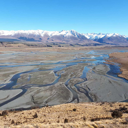
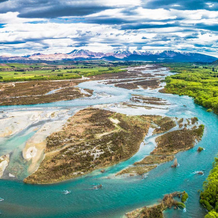
Covering approximately 164,000 hectares, Canterbury has more braided rivers than any other region in New Zealand.
There are seven alpine braided rivers that contribute 88 per cent of the flow within the region. These are the Waiau Toa/Clarence, Waiau Uwha, Hurunui, Waimakariri, Rakaia, Rangitata and Waitaki Rivers.
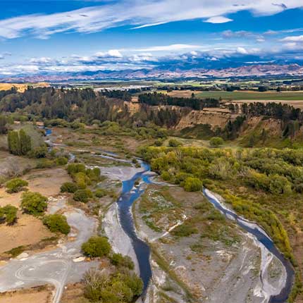
There are three main hill-fed rivers, Ashley River/Rakahuri, Selwyn/Waikirikiri and the Ashburton River/Hakatere. There are other smaller rivers that are also braided or are fed by braided networks.
At more than 200 kilometres long, Waiau Toa is the longest river in Canterbury and the eighth longest in New Zealand.
In Māori tradition, the Waiau Toa and nearby Waiau Uwha are romantic partners who were turned into their respective rivers, the increased flow of snow melt representing their tears over being separated.
Waiau Toa refers to the male river and Waiau Uwha, the female. Historically, the Waiau Toa area was famous for mahinga kai.
Both the Waiau Uwha and Waiau Toa have their sources on either side of the St James Range, roughly two kilometres apart, but flow in different directions, ending 80km apart at their mouths.
Previously known as the Waiau River before being formally changed in 2018 to reflect its original Māori name, Waiau Uwha flows eastward to the Pacific Ocean.
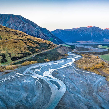
Flowing through alpine, hill-country and lowland plains from the eastern side of the Southern Alps to the Pacific Ocean, the Hurunui River has been described as one of the most diverse of Canterbury’s large rivers.
It once provided an important mahinga kai resource for Ngāi Tahu, although those resources are now in a modified and depleted condition.
The Ashley River/Rakahuri flows from a mountain range in the west Lees Valley and exits the foothills through a canyon called the Ashley Gorge near Oxford township.
After previously being known as Ashley River, it received the dual name Ashley River/Rakahuri through the Ngāi Tahu Claims Settlement Act 1998.
The Waimakariri River is one of the largest rivers in Canterbury and has traditionally been a well-known source of mahinga kai with numerous kāinga nohoanga and kāinga mahinga kai situated along the length of the river.
The name Waimakariri refers to the makariri (cold) mountain-fed waters.
Known originally to Māori as Waikirikiri, the river was renamed in the late 1840s to honour of the country's Anglican Bishop. Today the river wears both names.
The Selwyn River/Waikirikiri is fed from two sources - rain in the foothills and small springs in the lower plains. Its Māori name has been translated by the New Zealand Ministry for Culture and Heritage as "gravelly stream".
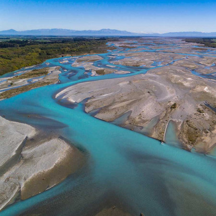
The Rakaia River, in the Canterbury Plains, is one of the largest braided rivers in New Zealand. It was a traditional mahinga kai site for Ngāi Tūāhuriri, with up to 1,000 earth oven sites recorded around the river mouth, indicating large scale specialised moa-hunting for food supply was carried out here.
The Rakaia had a Water Conservation Order placed on it in 1988, in recognition of its importance.
The Hakatere flows across mid-Canterbury. The official name of the river was amended to become a dual name by the Ngāi Tahu Claims Settlement Act 1998.
Early canoe travellers used Hakatere as a resting point and food gathering place and it was a major kai provider for Ngāi Tahu, particularly those based at Kaiapoi Pā.
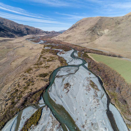
The Rangitata River was an important source of mahinga kai and was also an important access trail to Te Tai Poutini (the West Coast) for Ngāi Tahu.
The Rangitata has had a Water Conservation Order since 2006, in recognition of its value. It is also referred to as the Rakitata using local dialect and has been variously translated as 'day of lowering clouds', stairway to heaven', and 'the side of the sky'.
Waitaki River was said to have been formed when Aoraki (one of the sons of Raki, the sky father, and Papatuanuku, the earth mother) and his brothers' waka ran aground.
They were turned to stone, becoming Aoraki and the surrounding mountains. 'Waitaki' means 'the river of tears', symbolising the tears of Aoraki Mt Cook, missing his family.