Partnerships give boost to deliver $2M in environmental projects
Thanks to our partnerships with community groups, rūnanga, landowners and other funding providers, we delivered 20 priority environmental projects across the region in 2022/23.
These projects covered a wide range of environmental protection and enhancement goals, including protecting native braided river bird habitat in Waiau Toa/Clarence River (Kaikōura), supporting community planting at Steadfast Stream (Whakaraupō/Lyttelton Harbour), and taonga mudfish habitat protection and enhancement in Taiko Stream (Timaru district).
We set aside $300,000 annually for Zone Delivery Priority Projects, as established in the Long-Term Plan 2021-31. This enables us to make a significant contribution towards priority projects that improve our environment in collaboration with the community, stakeholders, rūnanga and other partners.
In 2022/23, our funding was boosted by financial and in-kind support from partners, landowners and other funding providers - ultimately contributing to over $2 million in on-the-ground delivery.
Spotlight on the northern zones
Key features for the northern projects were:
- supporting the set-up of catchment groups
- grassroots efforts for trap building
- full-scale habitat protection for nesting birds
- and wetlands and mahinga kai.
Our northern water zones are Kaikōura, Hurunui Waiau Uwha and Waimakariri.
One of the best examples of longstanding commitment and great environmental and community outcomes is the Love the Lyell project.
Love the Lyell (Aroha te Waikōau)
Waikōau/Lyell Creek catchment in Kaikōura has seen major improvements in water quality, biodiversity and mahinga kai values over the past eight to ten years through continued community action in partnership with local government and iwi.
Past restoration work has involved planting, fencing for stream protection, wetland enhancements, erosion control, mahinga kai and protection of existing terrestrial biodiversity as well as additional landowner engagement and education. This year, our support has focused on protecting the gains made in previous seasons by maintaining enhancement plantings and weed control in some of the key restoration areas.
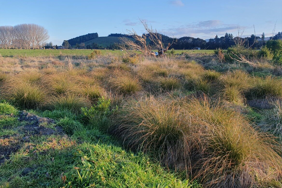
A great example of the success of this project can be seen in the Nagari Wetland, an ecologically rich freshwater marsh on the Kaikōura Flat in the Lyell catchment, situated on a working farm. Restoration efforts began by simply fencing off an area of wetland and allowing the natural vegetation to flourish uninterrupted by stock.
Read more about the Love the Lyell (Aroha te Waikōau) project
By allowing areas to naturally regenerate, managing weeds and maintaining native planting, it's become one of the most significant natural lowland wetlands in the district, covering around seven hectares of land over two areas in the catchment.
Senior biodiversity advisor, Heath Melville, said that with 900 sedges, 40 kahikatea and 950 tree, shrub and flax species planted, Nagari now provides an ecologically rich habitat for plant, bird, animal and aquatic life.
"The existing rushland and stream is home to pūkeko, ducks, kingfisher and heron, along with various invertebrates, fungi and fish species."
Heath believes Environment Canterbury's long-term commitment to the project and community partnership is the key to its success, including support from Kaikōura District Council and the Kaikōura Water Zone Committee.
"Our role has been about demonstrating a 'can-do' attitude and ensuring the completion of a range of freshwater-biodiversity projects in this catchment. Locals involved in past community planting days have opportunities to revisit the sites and witness our shared vision for freshwater, unfold."
Along with aesthetic improvements and enhanced mahinga kai and cultural values, there have also been notable ecological benefits. Establishing native vegetation in riparian areas and wetlands on private and public land will provide in-stream shade, reduced soil erosion and nutrient loss, provided food sources for native fauna, and native seed sources to spread.
The next steps will be continuing the mahi with both the urban and rural community, and looking for further opportunities to collaborate on freshwater-focused initiatives - with growing interest from local schools.
Next steps for the northern zones
- Kaikōura: Ongoing maintenance and enhancement of existing projects including additional planting along sections of the Lyell and supporting a landowner with a contribution towards fencing a wetland.
- Waipara Hapua: Willow control across a two hectare area of coastal wetland, which will help boost native biodiversity and increase landowner education and engagement.
- Amuri Basin Future Farming: Ongoing support (alongside Ministry for Primary Industries funding) to ensure the establishment of 13 catchment groups across 137 farms in the Amuri Basin.
Spotlight on the central zones
A key feature in the central zones was to give support to community groups working on landscape-scale biodiversity outcomes and community engagement.
This has produced results far beyond our ability to act alone. Projects included the Avoca Valley Restoration project, Te Ahu Pātiki/a> - a new conservation park in Whakaraupō/Lyttelton Harbour, and Te Ara Kākāriki, a Greendot Programme to create a native corridor from the Southern Alps to Te Waihora/Lake Ellesmere and Te Pataka o Rakaihautū/Banks Peninsula.
We also continued our work to support the recovery in the Eastern Bays after the 2021 floods destroyed native habitats and protective fencing.
Our central water zones are Christchurch West Melton, Banks Peninsula and Selwyn Waihora.
Eastern Bays flooding response
The Eastern Bays area is often called the 'Wildside' because of its remoteness and exceptional biodiversity values. It has more native forest cover than anywhere else on Horomaka/Banks Peninsula and is home to many endemic, threatened and iconic species of terrestrial animals and plants.
The marine environment supports the iconic Hector's dolphin and the largest mainland breeding colony of the endemic white-flippered blue penguin at Pohatu/Flea Bay.
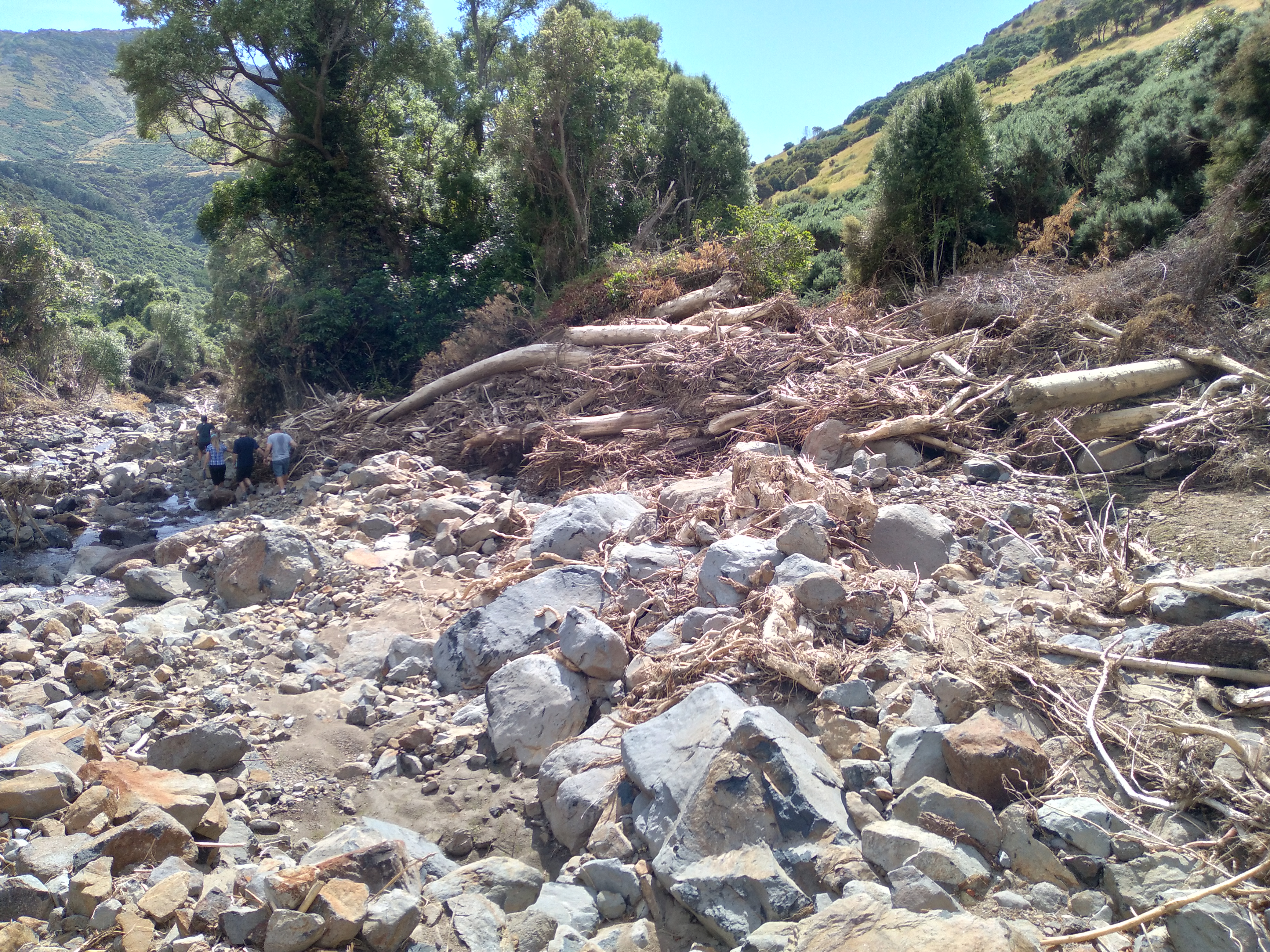
Unfortunately, the December 2021 floods had a devastating effect on the whenua/land in the Eastern Bays. As well as widespread damage to properties and roads, it destroyed kilometres of critical conservation fencing that was protecting vulnerable waterways and areas of regenerating native forest under QEII National Trust, Banks Peninsula Conservation Trust covenants.
Find out more about the Eastern Bays flooding response
We knew that landowners needed urgent help to get these fences repaired quickly to stop predators from entering conservation areas. In the first financial year (2021/2022), we provided $93,000 of financial assistance to more than 20 Eastern Bays landowners to undertake this work. This year (2022/2023), we built on these efforts and provided a further $39,000 to assist landowners in Goughs Bay and Hickory Bay.
Nigel and Tracy Flatman's property in Goughs Bay was one of the areas that was hardest hit. Nigel said sections of the Goughs Bay stream looked like a bomb had gone off.
"A wall of water had ripped banks to pieces, stripping off fences and forest and destroying floodgates. The Environment Canterbury funding was a godsend, allowing the progressive restoration and extension of flood damaged conservation fencing and flood gates on the property. We have completed about 600 metres of fence and all the floodgates were repaired."
In Hickory Bay, the funding helped with repairs to a QEII Trust covenant boundary fence that protects 150 hectares of regenerating and second growth hardwood forest. It also supported repairs to floodgates and fencing on another property, protecting surrounding native forest and the Ellangowan Stream.
Many landowners in the area were also concerned about the impact of the floods on native fish populations. They had been finding dead fish along stream banks and even in adjacent paddocks. In 2022/2023 we worked with landowners and other agencies to undertake fish survey work. While only a limited number of streams have been surveyed to date, preliminary information is encouraging and suggests that populations are recovering.
Zone delivery lead for Banks Peninsula and Selwyn Waihora, Gill Jenkins, has been pleased to see the results of this funding.
"Providing assistance to protect some of the areas that are so important to biodiversity on the Peninsula was one way we could help when the community needed it," she said.
"We knew the funding and advice would assist with the post-flood recovery of biodiversity and the enhancement of water quality and mahinga kai values, which are key priorities of the Banks Peninsula Zone Committee and Canterbury Water Management Strategy."
Next steps for the central zones
- Te Ara Kakariki: Supporting the Greendot Programme (final year of funding).
- Whakaraupō Te Ahu Pātiki: Supporting the setup of the new conservation park concept (final year of funding). Leveraging funding from multiple agencies - Christchurch City Council, Rod Donald Trust, QEII, private investors and Ngāti Wheke.
- Whakaraupō Whaka-Ora Catchment Plan: Supporting key catchments such as Foleys and Steadfast Stream catchments within the harbour in conjunction with landowners, QEII National Trust covenants, Conservation Volunteers New Zealand, Ngāti Wheke, and the other Whaka-Ora Healthy Harbour partners.
Spotlight on the southern zones
Key features of the southern projects were:
- weed control to support braided river habitat,
- wetland enhancement, riparian restoration and bird-breeding habitats.
Several projects involve multiple agencies and many are supported or led by community groups. Working with local catchment groups in Pareora/Kakahu, Tengawai and the Ahuriri catchments has been fundamental to delivering on key local aspirations and challenges. This is largely thanks to the groups' already-formed pathways to solutions and opportunities.
Our southern water zones are Ashburton, Ōrāri Temuka Ōpihi Pareora, Upper Waitaki and Lower Waitaki South Coastal Canterbury.
Weed control in the Upper Ōhau River catchment
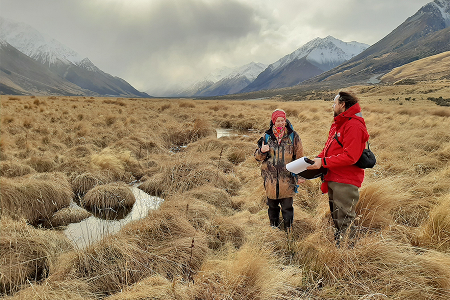
The unique ecosystems of the Upper Ōhau River area - including braided riverbeds, wetlands and native beech forest - are now better protected thanks to the completion of a major weed control project.
We collaborated with local landowners Glen Lyon Station, Toitū Te Whenua LINZ (Jobs for Nature fund), the Upper Waitaki Water Zone Committee and Project River Recovery of the Department of Conservation (DOC), on the three-year project to target a range of introduced pest species – including crack willow and Russell lupins.
Find out more about the weed control project in the Upper Ōhau River catchment
These weeds can dominate existing native vegetation and landscapes, as well as modify river channels, which are important habitat for threatened species such as the upland longjaw galaxais fish, and braided river birds including the kakī/black stilt, tarapirohe/black-fronted tern and ngutu pare/wrybill.
Upper Waitaki zone lead, Peter Burt, said the joint project is a fantastic example of undertaking proactive weed control work to ensure a better ecological future for a special area.
"This is a stunning and remote landscape and luckily the horse hadn't bolted yet in terms of these invasive species, so we were able to take advantage of a window to take action and protect the area. Once the seedlings for these invasives spread, it's very difficult to get rid of them.
"Working collaboratively was the key to being able to complete this project over a three-year period and we are really pleased to have got these weeds under control over such a vast area."
Contributions from agencies and landowners provided a combined budget between $70,000 and $100,000 per year. This investment has been successful in removing crack willows and lupins from 1,800 hectares of braided river and wetland habitat, and controlling outlying populations of cotoneaster, elderberry and old man's beard that threaten beech forest and native shrublands in the upper valleys.
DOC senior ranger for project river recovery, Dean Nelson, said that recent surveys had indicated the Dobson was an important site for the threatened upland longjaw galaxies.
"This work to maintain the dynamics of the braided river channels is critical to ensuring that this population continues to thrive."
A key challenge for the team was the scale and variety of the different types of weeds.
Senior biodiversity officer Kennedy Lange said they used different approaches across the area.
"We needed to control outlier populations as a priority while chipping away at core populations to limit seed input. Control techniques included ground spraying and cutting, and aerial boom and spot spraying - and the follow up assessments have shown excellent results so far."
With large parts of the project area now only needing minor maintenance control, the project partners are now setting their sights on extending the work to include the Lake Ōhau shoreline and surrounds to ensure these landscapes and habitats are protected into the future.
"This is still largely a natural ecosystem compared to other places in New Zealand' Kennedy added, "so it's great that we've been able to nip some of these weed issues in the bud."
Next steps for the southern zones
- Carters Creek: Surface water quality sampling programme - closely working with and supporting community groups.
- Kakahu: Working with upper catchment farmers to establish where the issues are, and funding the installation of sediment traps to reduce sediment running into the Kakahu River.
- Hakataramea: Maintenance and weed control in the upper reaches, targeting willow, lupin, broom and barberry.


